
Problem: GIS is often used for mapping out large linear networks that depict waterways, pipelines, railways, and roadways at the local, state and interstate route level. These networks can be very large and have many attributes that change along each of the linear segments. As a GIS analyst it is important to understand the concepts and tools for managing a linear referencing system with the ability to manage the information to answer questions asked.
In this example a linear referencing systems in GIS is used by a state highway department of transportation because of it's usefulness in characterizing a lot of information along each roadway segment. The transportation agency is using the linear referencing system to keep track of their current roadway network and associated traffic accident and pavement condition information to see if there is any correlation that would be reported as the number of accidents per roadway mile at various pavement condition index thresholds.
Analysis Procedures: Work with the department of transportation first included assessing the roadway network information provided, using ArcMap 10.4.1, to understand all of the data attributes and how the various roadways are segmented. ArcMap 10.4.1 was also used to overlay traffic accident and pavement condition data together to create new layers that allowed the determination of the number of accidents per mile on different routes with varying pavement condition indexes (PCIs).
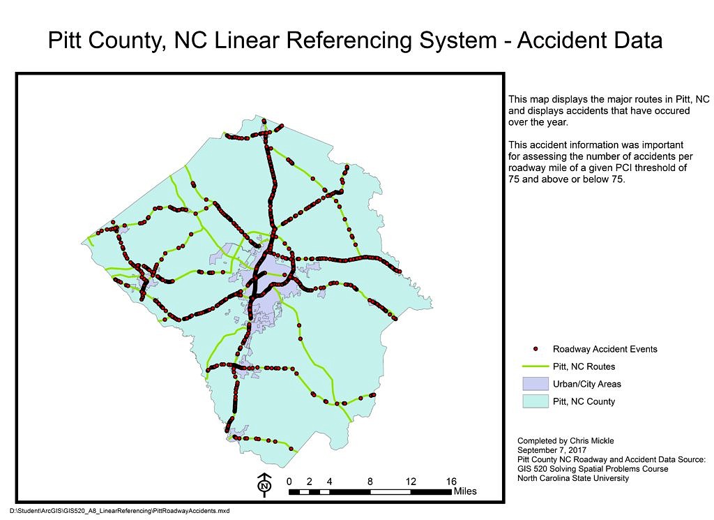
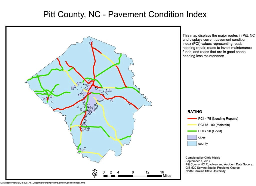
The methods implemented to reach our conclusion on the number of accidents per roadway mile for different pavement thresholds started with obtaining and analyzing the route network, accident, and pavement condition data. Since the route network is geospatial polyline data it can be displayed on a map. However since the accident data and pavement data are not spatial they needed to be converted to event data along different linear route segments respectively. This was done using the Linear Referencing Make Event Layer tool and relied upon mile start and end measurements for pavement condition data and individual measurements for the accident data. Once pavement and accident data have been made into event data they were intersected using the Overlay Route Events data. The output of this tool was another table that was also converted to an Event layer using the Linear Referencing Make Event Layer toolbar. Finally the “Select by Attribute” and “Statistics” tools were used to identify and calculate the number of accidents per mile for a given route where the PCI is above and below a 75 rating.
Results: A linear referencing system was established for Pitt County, NC to allow the department of transportation to identify the number of accidents that occur on roadways with a PCI <= 75 and > 75.
Application & Reflection: Linear referencing systems have been in use for managing pavement information for a long time. MicroPaver is a pavement condition software system developed by the U.S. Army Corps of Engineers which follows the ASTM D6433, Standard Practice for Roads and Parking Lots Pavement Condition Index. This system requires a roadway network centerline file which can be uploaded and the attributes of each roadway segment create the database records or which pavement is inspected and then entered into the system. The application utilizes a MicroSoft Access database back end and has recently been upgraded in version 7 to include a SQL server database interface. This application is a good example of using a linear referencing system although there may be room for increasing the dynamic segmentation by having events recorded outside of the individual linear segments.